Marin County, CA
Hikers: Cathy, Laura
Distance: 11.5 miles
Elevation Gain: 1,661ft.

The picture above and the next nine photos were seen on the drive in (via Hwy 1).

Lots of seals!! :)


And some babies too. :)


This was an interesting sight to see. Several radio antennas on the grounds of the old Marconi/RCA Bolinas Transmitting Station on Mesa Road.


The Palomarin trailhead parking lot was full by the time we arrived at just after nine-thirty. Rangers were directing us latecomers to park down the road.


There were poppies galore, as well as other flora.


Bass Lake
("Unofficially the best swimming spot in Point Reyes" - park website)
("Unofficially the best swimming spot in Point Reyes" - park website)


A small waterfall under all that brush.


Pelican Lake


The sign for Alamere Falls Trail (which according to many websites, is officially closed; though there were no signs indicating such.) - we decided to catch the falls via Wildcat Camp and come back up this way. Notice it reads dangerous conditions - they're not kidding. Not one we would take again.


The trail has become a little overgrown from the recent rains.


Catching a glimpse of the falls.


This would have been the perfect spot for our egg break - sadly it was extremely windy at the top of this hill.


The campground was covered in mustard plant - stunning.


How beautiful is this?!!! There were several picnic tables nestled all through the mustard plants.


It's a good idea to check tide tables before you head out, so you don't get trapped on the beach at high tide.


It was so windy, small rocks (and a few not so small!) were showering down on us as we walked along the beach -a bit unnerving.


We got lucky - the tide was on its way out; only got brushed by one wave - came up just above our ankles.


How Laura got this shot with no people in it, is amazing... it's a popular destination to say the least.

Alamere Falls is a rare "tidefall" - a waterfall that flows directly into the ocean. There are only two in the area, according to Wikipedia; the other being in Big Sur.


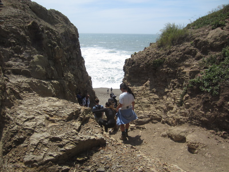
The line to go up the Falls Trail - it was slow going. The photo does not show how severe the climbing is. It was loose shale rock and a couple of deep steps, and the wind was throwing dust into the eyes. We had people pushing our rears from below, while being pulled from above. Not to mention people are also coming down at the same time. It was crazy!
People going down the Falls Trail.

Upper falls.


Trails :
(from the Palomarin trailhead.)
Coast Trail, Ocean Lake Loop, (Wildcat Campground), Wildcat Beach, Alamere Falls Trail*.
*"Please take note! Many
social media posts and older (and some newer) guide books reference the
Alamere Falls Trail: this is NOT a maintained trail, and poses many
hazards to off-trail hikers—crumbling and eroding cliffs, massive poison oak, ticks,
and no cell phone service. Visitors who use this unmaintained trail may
endanger themselves and rescuers, and inadvertently cause resource
damage. On an almost weekly basis, visitors get hurt scrambling down the
heavily rutted route leading to the top of the falls or sliding down
the crumbly cliff-face to get to the beach, sometimes requiring search
and rescue teams to be mobilized. The National Park Service strongly
advises visitors against using this unmaintained route. Please use the
recommended routes to visit the falls." - (source)