San Pablo Reservoir (Starting from Briones Overlook Staging Area)

August 3, 2014
Contra Costa County
Hikers: Cathy, Laura
Miles: 8
Elevation Gain: 977 ft. 


Easy hike (mostly flat, with a few rolling hills in between), but oh so beautiful!

We knew it was going to be a good day when we saw these creatures on our way there.


The Briones Reservoir spillway.

Goats!

My sister spots the coolest stuff on the trails! Laura, your trail name is Eagle Eye. This was in the middle of a spider web.


We found the rest of the duck up the trail. It looked as though just the wing was ripped from his body. Poor duck.


Looks as though this tree imploded.


This bench is at the EBMUD Watershed Headquarters, just off the trail.

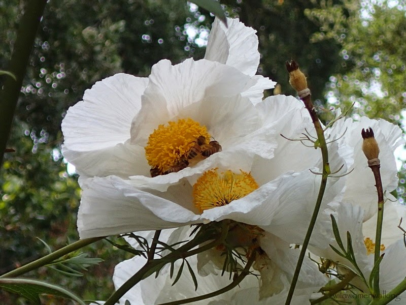
There were four or five bees all on one flower.

Delicious berries!

Bunny in the brambles. Brambles. I just love that word, don't you?. :)

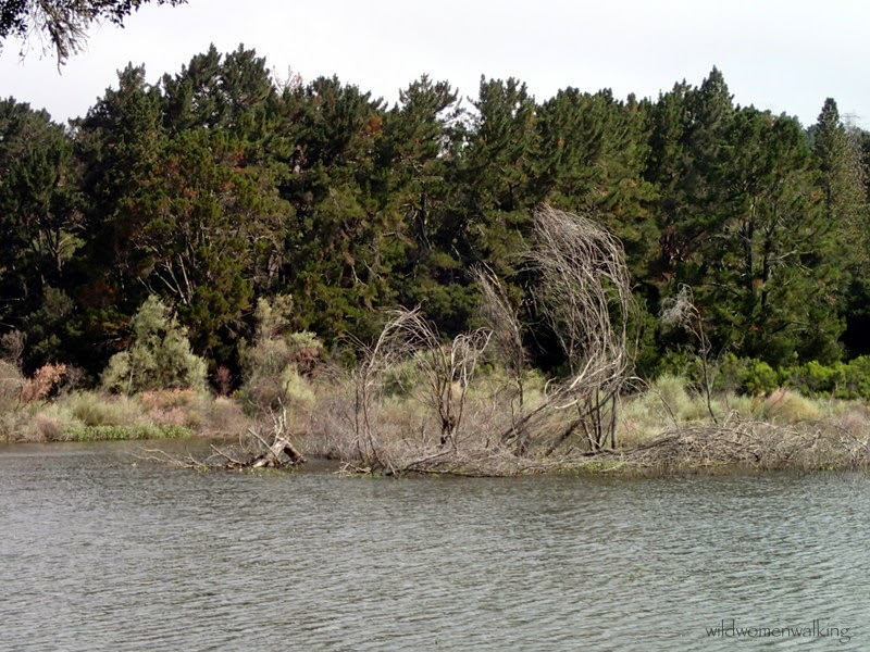


The algae was so thick and green, Laura said it looked like the grass of a golf course.


Laura, I just love this shot!


These colorful boulders caught our eye, so we just had to venture down the service road. The next eleven pics are from this road. The view at the end was just stunning. The pics do not do it justice, as beautiful as they may be.


Walked right over this little critter!


Looks like a good spot to have a bite to eat before turning back.

Having a picnic table is always a plus!


Could not ask for a better view while lunching!


Could that be an otter! Um, no. Not in a reservoir! Turned out to be a plastic bag (I think).

The Oakland Strokes Rowing Club's launching ramp.


A couple of birds hanging out.


The last stretch - up the spillway. This is the only real climb of the walk. We could have taken the trail back (the way we came), but we like taking the spillway - a little change of scenery.


Swallow's nests.


Anyone know, what purpose these metal plates on the spillway serve? They were three wide, and about every thirty feet.

Same goats. :)


Trails:

Oursan, Old San Pablo, Service Road, Inspiration (just a tad.. will return to complete).


Permit Required

We have hiked on EBMUD property at least ten times before today if not more, and this was a first that we were stopped and asked if we had a permit. We were happy to say, why yes we do! It's only ten dollars a year, and can be printed out at home from the EBMUD website. It's well worth the cost.


Bear Creek Trail to Dam and Back | Briones Reservoir

July 27, 2014
Contra Costa County
Hikers: Cathy, Laura, Carol
Distance: 8.3 miles
Elevation Gain: 1,245 ft.


Still taking it easy after a 6 week hiatus.


Interesting cloud formation seen on our drive in. 

The reservoir is getting so low. The water used to come up to the grassy area. 


The "sticks" in the middle are water level gauges. Bone dry.


Here is a photo from July 2012. Not the same spot, but not too far from the others shown above.


 Kelley, if you are reading this, this is past the Bear Creek Trail. :)

  Trails:
Bear Creek Trail
 
Briones Reservoir - (for trail map - click on North Watershed Map)
(Permit required)

Briones and a Close Call

July 13, 2014
Martinez, CA
Hikers: Cathy, Laura
Distance: 4.67 miles
Eleveation gain: 1,227 ft.


 Laura trying to get a picture of a rattlesnake.

See him hiding out?

 (Holding my bandana up to block the glare from the sun)

Laura walked by first. Not sure I have ever heard such a loud rattle. She sprinted, to say the least. Our dilemma - we are separated by a snake. What to do? Walk by slowly? Run? WWND?

Me, the chicken shit, got up  the courage to sprint past it! And my sister, the one who is not afraid of anything - ever. Not even a pack of coyotes, said, uh - no. Not a good idea. Just walk through the grass (snake country!) on the other side.  Well, our friend did not like that either - it shook that tail like crazy.

Laura made me go back the way we came, and she went on, and we met at the pass.


So sad to see our ponds bone dry. (Notice Mickey Mouse at the top!)